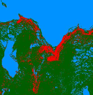
By comparing satellite images over 3 decades, the accumulated extent of vegetation loss at La Pérouse Bay, Manitoba and Akimiski Island, Northwest Territories can be seen. The red areas are the areas of devegetation in the interval of years shown. This shows the extreme nature of the impact on local sites when high numbers of geese are concentrated. Philopatry (the tendency of geese to use the same areas year after year) coupled with the social attraction of other geese (the decoy effect) amplifies the impact of these otherwise quite natural feeding processes.
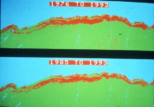
The images show without doubt the spreading effect on ecosystem processes and other components beyond the geese themselves, and underscores the importance of recognising the problem, attempting to manage it, and continuing to conduct research to understand it and guide management actions.
next slide | previous slide | slide show opening
revised - 12/18/02