 |
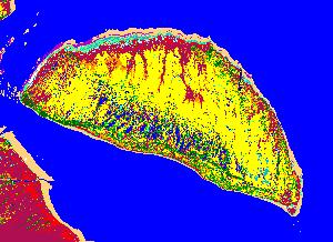
A vegetational map based on supervised classification is being prepared for the Hudson and James Bay lowlands. Two coastal categories that are recognized are supra- and inter-tidal areas, both frequented by Canada and snow geese. The inter-tidal area consists largely of Puccinellia phryganodes and Carex subspathacea swards, prime forage for lesser snow geese. The total area of these respective marsh categories can be calculated and corrected for decrease in vegetational cover over the last decade. Supervised classification will be extended to Akimiski Island and the southern James Bay mainland of Ontario to coastal Manitoba. This information is required to determine the carrying capacity of these coastal ecosystems. |
Supervised classification map for Akimiski Island |